Winyah Bay North Island Living Shoreline
Description
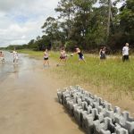
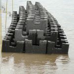
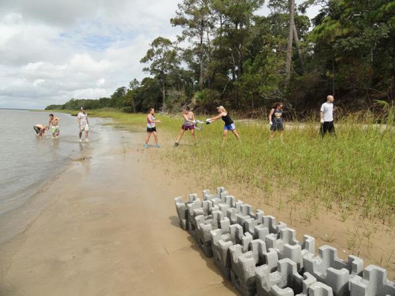
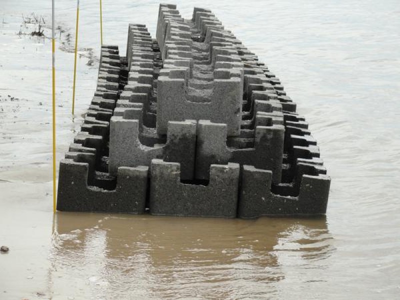
The North Island project included 360 castle blocks that were sited along the edges of existing marsh grass populations that displayed signs of erosion (i.e. – jagged edges of old marsh edge with apparent clumps of grasses falling into the water). After the installation of the South Island project, TNC partnered with Coastal Carolina University (CCU) to conduct a vibracore analysis on the islands to access the sediment profile. After the completion of that field work, CCU provided TNC with a historic shoreline map that indicated South Island’s constant erosional pattern and North’s Island’s slightly accreting pattern. TNC contracted with CCU to conduct the monitoring of the South Island site for approximately 12 months and worked with Dr. Jenna Hill, along with her two interns and colleague, to finalize that monitoring in October 2012. The report concludes: “Observations and analyses conducting during the North Island living shoreline monitoring project suggest that the living shoreline castle installations have been relatively successful in recruiting oyster growth and promoting sediment accumulation. Although this is a relatively low energy section of estuarine shoreline, there does appear to have been substantial subsidence and/or sediment burial of the castle structures. In addition, a shift to coarser grain sizes within the surrounding sediments during the monitoring period suggests there may be some winnowing and/or scouring of sediment around the living shoreline castles that could have an adverse impact on the shoreline. Unlike the southern tip of the Island, this portion of North Island has not been subject to large scale shifts in shoreline position in recent history; therefore it is difficult to assess the true potential for shoreline stabilization by living shoreline castle installations given the relative inherent stability of the study site. In comparison with living shoreline studies conducted on South Island, across the Winyah Bay estuary, during Phase I of the project, the longer, more linear castle configuration and lower elevation placement appears to have resulted in significantly improved oyster recruitment as well as sediment accumulation.
Objectives: Successful Habitat Restoration, Environmental Benefits, Human Well-being / Quality of Life
Technical Details
0.005165 Acres of Oyster reef/shell bottom restored.
Species: Crassotrea virginica
Data Collected: oyster surveys, water quality, sediment accretion
Funding
Partners: Horry Georgetown Technical College, South Carolina, Department of Natural Resources, United States Department of Fish and Wildlife Service, Coastal Carolina University
Volunteers: 41 volunteers engaged, 282 total volunteer hours
Contact
- Joy Brown, SCFO
- This email address is being protected from spambots. You need JavaScript enabled to view it.